Independent Arctic field notes · Not a tour operator

Icefjords, Ice Caps and Calving Fronts

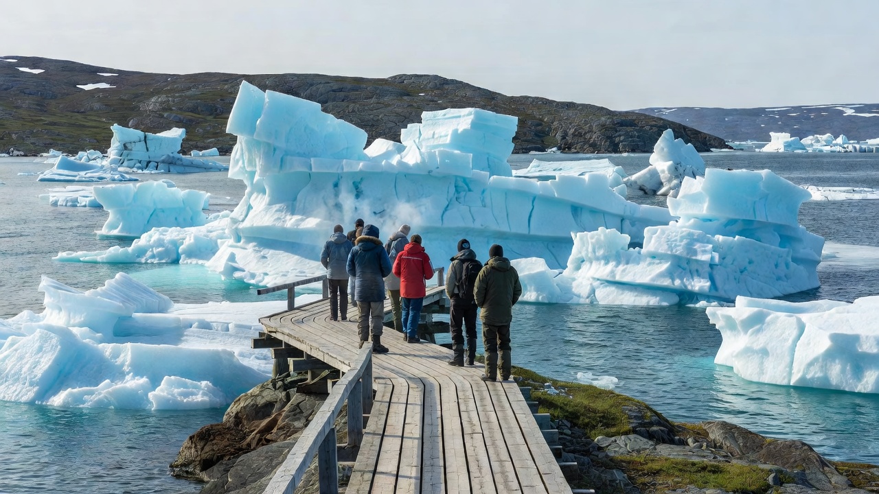
Walkers on the wooden boardwalk trail at Sermermiut looking out over a fjord packed with huge icebergs at the Ilulissat Icefjord, Greenland

Featured · Ilulissat Icefjord, Greenland

A Fjord Choked With Ice

Stand on the rocks above Sermermiut on a still evening and you can hear the Ilulissat Icefjord before you understand it: groans, cracks and the occasional boom as bergs shift in the jam. Sermeq Kujalleq, the glacier at the head of the fjord about 40 km inland, drains a large share of the Greenland ice sheet. Its flow sped up markedly in the early 2000s, and researchers have recorded summer speeds of tens of metres per day, among the fastest ever measured for a glacier. The fjord was inscribed as a UNESCO World Heritage Site in 2004.
Three Kinds of Ice You Will Meet

Glacier vocabulary is easier once you see it on the ground. An ice sheet is a continental-scale dome of ice, and the Greenland ice sheet is the only one in the Northern Hemisphere. An ice cap is smaller, covering highlands rather than a whole landmass; Vatnajökull in Iceland and Austfonna in Svalbard are classic examples. Outlet glaciers are the rivers of ice that drain sheets and caps, and where they meet the sea they become tidewater glaciers with a calving front, the cliff from which icebergs break away.

The ice in a calving front can be centuries old, compressed until the air bubbles are squeezed out, which is why freshly exposed faces glow blue. Floating chunks come in grades sailors still use: bergy bits the size of a house, growlers the size of a car, and full icebergs that can tower above a ship.

Glacier Comparison Notes

A plain-language comparison of glaciers and ice caps that travellers commonly visit or read about. Scroll sideways on small screens.

Selected Arctic and sub-Arctic glaciers by type, region and how visitors usually see them
GlacierTypeRegionHow visitors see itWhy it matters
Sermeq Kujalleq (Jakobshavn Isbræ)Outlet glacier of the ice sheetIlulissat, West GreenlandIcefjord trails, boat trips in Disko Bay, sightseeing flightsOne of the fastest-flowing glaciers; UNESCO-listed icefjord since 2004
VatnajökullIce capSoutheast IcelandGuided glacier walks and winter ice caves via Skaftafell and JökulsárlónIceland's largest ice cap; national park on the UNESCO list since 2019
BreiðamerkurjökullOutlet glacier of VatnajökullSoutheast IcelandFrom the shore of Jökulsárlón lagoon and Diamond BeachIts retreat created the lagoon, which has grown since the 1930s
NordenskiöldbreenTidewater glacierBillefjorden, SvalbardBoat day trips from Longyearbyen, often with a stop at PyramidenA visible example of retreat in central Spitsbergen
AustfonnaIce capNordaustlandet, SvalbardFrom expedition ships along its long ice cliffsSvalbard's largest ice cap, with one of Europe's longest calving fronts
Petermann GlacierOutlet glacier with floating tongueNorthwest GreenlandRarely visited; known through satellite and research dataLost large ice islands in 2010 and 2012, studied closely by scientists
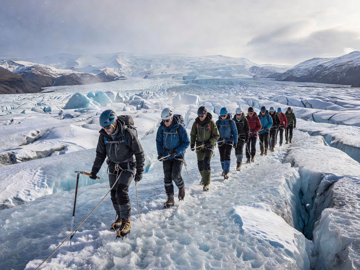
A roped group of hikers wearing helmets and crampons following a guide across the crevassed surface of an outlet glacier of Vatnajökull, Iceland

Field note · Vatnajökull, Iceland

Crampons on Vatnajökull

Iceland is not strictly High Arctic, but Vatnajökull is where many people take their first steps on a glacier. Groups meet guides at Skaftafell, strap on crampons and helmets, and walk onto tongues such as Falljökull, learning to read moulins, meltwater channels and ash layers left by past eruptions. In winter, guided trips enter ice caves that form and collapse with each season, so no two winters offer the same cave.

Vatnajökull National Park, established in 2008 and inscribed on the World Heritage List in 2019, also covers active volcanoes beneath the ice. Glacier outburst floods known as jökulhlaups have reshaped the sandur plains to the south many times.

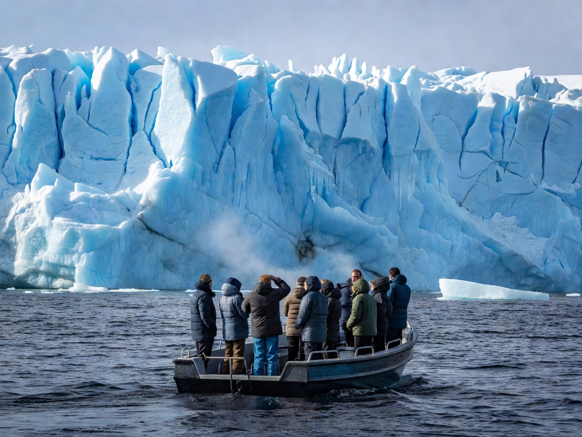
Passengers in warm jackets on a small boat watching the blue ice wall of a Svalbard tidewater glacier from a safe distance

Field note · Svalbard

Tidewater Fronts From the Water

Roughly half of Svalbard's land is covered by glaciers. From Longyearbyen, day boats cross Isfjorden and Billefjorden towards Nordenskiöldbreen, while expedition ships visit Monacobreen in Liefdefjorden and the long ice cliffs of Austfonna. The experience is about distance and patience: engines off, a pause of several minutes, and then a crack that arrives a second after you see the ice fall.

Calving sends waves across the water and can flip small boats, so skippers keep well back from the face. Kayakers and boaters should treat a calving front as a no-go zone, however calm the day looks.

Staying Safe Around Ice

  • Never walk on a glacier without a qualified guide, rope and crampons. Crevasses hide under thin snow bridges, especially in spring.
  • Do not climb on stranded icebergs on beaches; they can roll or split as they melt.
  • Keep well away from calving fronts on foot and by boat. Falling ice and the resulting waves are both dangerous.
  • Cross glacial rivers only with local knowledge. Meltwater rises through the day and can be deep, fast and cold enough to cause shock.
  • Check conditions with local authorities or guides each morning; in Iceland, the national park and the Icelandic Meteorological Office publish warnings.

Glaciers as a Climate Record

For scientists, glaciers are both measuring instruments and archives. Ice cores from the Greenland ice sheet preserve layers of past atmosphere, while repeat photographs from Svalbard, some dating to early 20th-century expeditions, show fronts that have retreated by kilometres. Organisations such as the US National Snow and Ice Data Center track sea ice and ice-sheet melt year by year, and Greenland's ice loss is one of the major contributors to global sea-level rise.

For travellers, that turns a glacier visit into something more than scenery. The view at Jökulsárlón or Ilulissat is a moving snapshot of change, and the people who guide you across it often know exactly where the ice stood when they began working.

Sources and Further Reading

Continue with the explorers who first charted this ice.